What is the Difference Between Sleet and Hail?
 Tricia Christensen
Tricia Christensen
Tricia Christensen
Sleet and hail have different properties, though they may look similar. They require different circumstances, weather conditions and seasons in order to be produced. Another category that should be compared to sleet and hail is freezing rain, which again has its own special conditions and characteristics. All three involve precipitation in the clouds, but each requires just the right set of circumstances to occur.
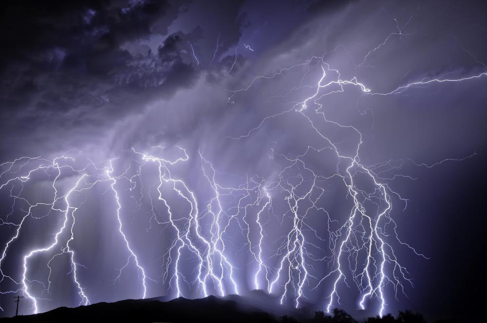
One difference between sleet and hail is the time of year in which each occurs. Typically, hail is most often a summer occurrence, while sleet occurs mostly in winter. You’re much more likely to see hail in warm and oppressive weather where a sudden thunderstorm occurs. In fact, you need cumulus clouds like thunderheads in order to produce hail.

Hail begins as raindrops at the bottom of clouds; "bottom" means those parts of the clouds that are closest to the earth’s surface. The action of updrafts sends raindrops toward the top of thunderheads, where the temperature is cool enough to cause the raindrops to freeze. The now frozen raindrops start to fall, but updrafts cause hail to swing up to the colder top of the clouds several times. Each time this occurs, hail accumulates more water from the lower clouds, which is then frozen to create layers. If it happens often enough, you might see huge pieces of hail fall to earth. More typically it goes through a few cycles and looks like pea-sized pieces when it hits the ground.

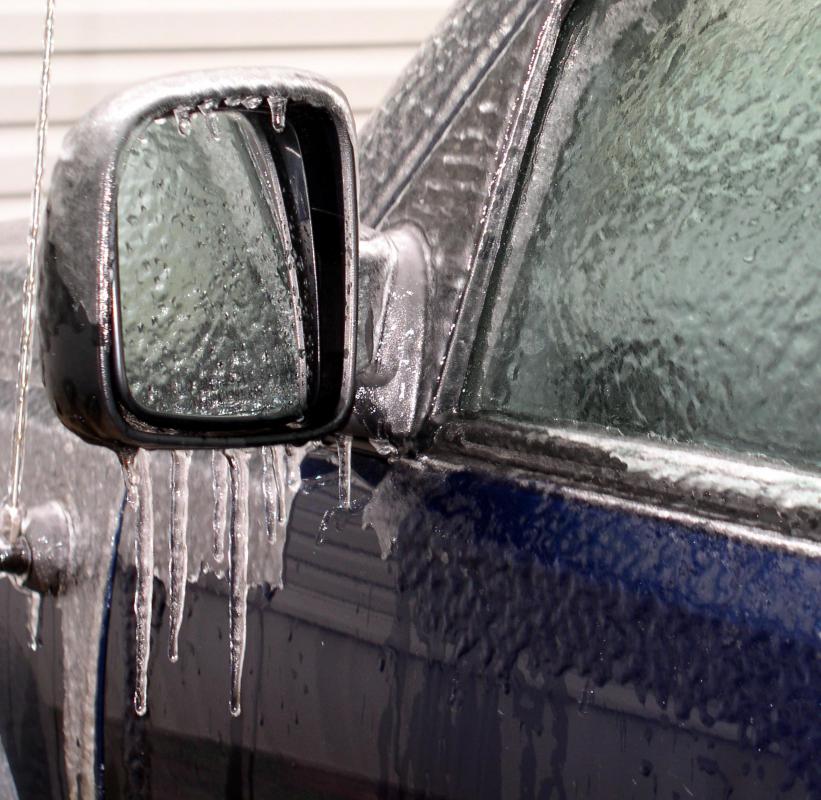
Sleet and hail may look similar, but the formation of sleet is quite different, and explains why sleet is more often a winter phenomenon. Clouds that might produce sleet are warmer than the air below, and don’t have significant updrafts. In fact when sleet falls from clouds it is still rain.
The temperature of the air, as rain falls from the clouds is cold enough to freeze it on the way down. Therefore sleet doesn’t freeze in upper cumulus, but instead freezes in the air. Sleet won’t be large since it doesn’t accumulate extra layers of frozen water. Instead, when it falls it looks quite small, like tiny glittering diamonds. It usually melts quickly, because the air on the ground is warmer than air a few feet up.

A phenomenon separate from sleet and hail is freezing rain. This is also typically a winter occurrence, but it requires freezing temperatures on the ground instead of in midair where hail freezes. Freezing rain tends to remain rain until it hits the ground, where it instantly hardens and creates a sheet of ice on the ground. Of the three types, freezing rain is often more dangerous to motorists than is sleet and hail. Due to low ground temperature, ice layers on the ground may remain for several hours to several days, creating slippery roads and very unsafe driving conditions.
Tricia Christensen
Tricia has a Literature degree from Sonoma State University and has been a frequent AllThingsNature contributor for many years. She is especially passionate about reading and writing, although her other interests include medicine, art, film, history, politics, ethics, and religion. Tricia lives in Northern California and is currently working on her first novel.
AS FEATURED ON:
AS FEATURED ON:

-
![Handful of hailstones.]() By: Gavin AndersonHandful of hailstones.
By: Gavin AndersonHandful of hailstones. -
![Ice on a car after a sleet storm.]()
Ice on a car after a sleet storm. -
![Cumulus clouds are usually needed to make hail.]() By: selezenjCumulus clouds are usually needed to make hail.
By: selezenjCumulus clouds are usually needed to make hail. -
![Hail may form during severe thunderstorms.]() By: valdezrlHail may form during severe thunderstorms.
By: valdezrlHail may form during severe thunderstorms. -
![Hail storms are more common in warm weather.]() By: Ivan MonteroHail storms are more common in warm weather.
By: Ivan MonteroHail storms are more common in warm weather.


Discussion Comments
O.K. Here's one to twist your turbans. When the April 27, 2011 tornadoes hit Alabama, the storm that hit Tuscaloosa had a lot of debris in it, obviously. By the time it got to Jasper, about 100 miles away, much of that debris had been carried into the upper levels of the atmosphere, where the air was below freezing. It had already been through the heavy rain in the storm and as a result, froze when it got to the upper atmosphere. People in Jasper reported "hail sticks" that were six to twelve inches long. They were sticks coated in ice after being up in the storm system. True story. You can check out ABC channel 33 in Birmingham for verification. They ran a story with photos. One of the weirdest things I've ever seen.
What a great article. I knew there was a difference between hail and other forms of winter precipitation, but I never knew there was a difference between sleet and freezing rain. I thought they were simply interchangeable names for the same thing.
Whatever the winter weather, it seems like the weather has become much less predictable as of late. I normally don't put my winter tires on my vehicle until November first since it's not good for your vehicle to run those tires on dry pavement. This year I was caught out in the rain, so to speak. We had a freak snowstorm in the middle of October that dumped two feet of snow on higher elevations, but only sleet and freezing rain at lower elevations. My car slid off the road, so I had my winter tires put on early. Ever since it has been mid 60’s every day, and no snow in sight. Go figure right.
@ Anon46886- Gropple or Grauple as it is technically referred to, is a combination of snow and rime. This type of snow usually only occurs during the beginning and end months of winter as well as the mid-winter thaw. The temperature and atmospheric conditions have to produce super cooled moisture that remains liquid as well as snowflakes. As the snowflakes swirl around in the atmosphere before falling, they collect microscopic drops of super cooled liquid water that instantly freeze to the snowflakes. The result is a dense but fragile bead of snow ta falls to the earth that we call grauple.
Grauple can be particularly dangerous when it falls on alpine climates. Grauple is much denser than regular snow, but it packs in a less stable fashion. Because it is essentially 2-5 millimeter balls of snow accretion, the structure is unstable. They crumble easily and have low moisture content for their size. This can cause sheet avalanches when a storm produces a large enough layer of grauple, or grauple is followed by a considerable amount of normal snow.
Where does gropple fit in?
Post your comments